Mountains
There are numerous mountains in Sri Lanka that not only takes away the breath of travelers but also satiate the thirst of adventure amidst the thrill seekers. Take a look at this list of top mountains that one should definitely conquer when traveling to the Pearl of the Indian Ocean, Sri Lanka.
Ritigala Mountain
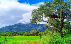
Ritigala is a mountain in central Sri Lanka which is home to an ancient Buddhist monastery. The ruins and rock inscriptions of the monastery date back to 1st century BCE. It is located 43 km (27 mi) away from the ancient monastic city of Anuradhapura.
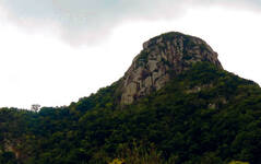
Ritigala mountain consists of four peaks which rise steeply from the surrounding plain. The mountain is 6.5 km in length, and divided into northern and southern blocks by Maha-Degala Gorge. The highest peak is Ritigala Kanda in the southern block
At 766 m (2,513 ft) above sea level, and 600 m (2,000 ft) above the surrounding plains, Ritigala is the highest mountain in northern Sri Lanka. The modern name Ritigala is derived from the ancient name Ariṭṭha Pabbata (Dreadful Mountain), mentioned in the Mahavamsa.
Its elevation is higher than the other main tourist attractions of the north central plains, namely Sigiriya, Dambulla, and Mihintale. The significance of this topographical feature lies in the abrupt sheerness of the massif, its wooded slopes, and the wet microclimate at the summit.
ClimateThe mountains intercept moisture-bearing winds and generate orographic precipitation, which makes the mountains wetter than the surrounding lowlands. During the northeast monsoon (December to February), Ritigala experiences the highest rainfall (125 cm) of entire dry zone
The wet micro climate at Ritigala is a singular occurrence in the north central plains, the ancient Sri Lanka’s “Wewu Bandi Rata” meaning “the land of rainwater reservoirs” in Sinhalese
The climate at the summit is in sharp contrast to the climate at the foot; it is cooler in comparison to hot and dry climate of the region. The mist and cloud cover which cover the summit during the south-west monsoon results in high vapor condensation, in turn, turning the earth moist when the plains all around are in drought.
Ritigala Strict Nature ReserveRitigala is a strict nature reserve, covering 1,528 ha (3,780 acres). It was established on 7 November 1941 (Gazette Notification No. 8809), and is managed by the Department of Wildlife of Sri Lanka together with the Forest Department of Sri Lanka.
LegendsLegends abound on Ritigala. One of mysterious aspect is the belief of powerful medicinal herbs found near the crest. A herb called “Sansevi” is believed to have the power of conferring long life and curing all human pain. According to legend, all vegetation on Ritigala is protected by Yakkas, the guardian spirits of the mountain. The venerable Prof. Walpola Sri Rahula Maha Thera (1907–1997), a Professor of History and Religions at Northwestern University, a Buddhist monk scholar, in his “History of Buddhism in Ceylon, says "the term “Yaksa” denotes superhuman beings worthy of respect. It is possible that it was applied, by an extension of meaning, also to some pre-Buddhistic tribe of human beings, aboriginal to Ceylon".
The legend has it that Prince Pandukhabaya (3rd century BC) was assisted by Yakkas during his battles against his eight uncles at the foot of Ritigala. Another legend refers to a duel of two giants, most possibly Yakkas, named Soma and Jayasena. Soma being killed in the duel, Jayasena became a legend.
The Legend of Lord Hanuman and RitigalaAccording to popular belief, non-human Lord Hanuman of supernatural powers, traveled over Ritigala, and, by accident, dropped a chunk off a mountain of the Himalaya range he was carrying from India to Lanka for its medicinal herbs. Lord Rama's brother, Prince Lakshmana was mortally wounded in battle and only a rare herb in the Himalaya could save his life. The pocket of vegetation of healing herbs and plants at the strange mini-plateau at the summit of Ritigala, which is distinct from the dry-zone flora of the lower slopes and surrounding plains at Ritigala, could thus be accounted for
Lord Hanuman has visited Lanka on a previous occasion. That was when he was sent by Lord Rama in search of his consort Sita. It was King Ravana, who seized Sita from Parnasali in India, the holy hut of Lord Rama and brought her to Asok Vana, a beautiful park at Sita Eliya (close to Nuwara Eliya or Little England, as the British called it three millennia later) on the Pusparaga (Dadumonara) in an air chariot, without touching her. Having found the location where Sita was held, Hanuman made use of Ritigala Kanda as a launching pad to take a leap across to South India. Incidentally, Ritigala is the highest prominence between the central plains of Sri Lanka and the coast of southern India
Ruins of the ancient monastery of RitigalaThe ruins of Ritigala monastery are located on the eastern side of the mountain at the foot of the gorge which separates the main peak from the northern ridge of the range. The ruins cover an area of 24 hectares (59 acres). The monastery precinct begins at the office of the on-site branch of Department of Archeology of Sri Lanka close to the foot of the reservoir named Banda Pokuna. The ancient man-made reservoir is a feat of engineering with a bund of polygonal plan completing a circumference of 366 meters. The construction of the reservoir is credited to King Pandukabhaya (437 -367 BC). The reservoir possibly served a ritual bathing purpose, with visitors bathing there before entering the monastery
The order of ritual bathing tank, ruins of entrance complex and a pedestrian path seem to indicate devotees in large numbers visiting the monastery. The procession is similar to that of Kataragama where pilgrims begins with a cleansing bath at Kataragama Manik river and end with an offering to the God Skanda, the benevolent Hindu deity of Kataragama at the main shrine
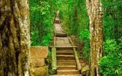
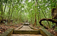
The edge of the reservoir is followed in a clockwise direction to arrive at the other bank, and cross the bed of the stream feeding the reservoir. The steep steps here onwards lead up to a beautifully constructed pavement, a stone path 1.5 meters wide that meander upwards through the forest, linking the major buildings of the monastery. The stone cut path is laid with interlocking four-sided slabs of hewn stone. Three large circular platforms at intervals along the pavement allow for rest.
Stone bridges, raised platforms and courtyardsThere are stone double-platform structures, Padhanaghara, which are characteristic of Ritigala and other forest monasteries such as Arankele, Veherabandigala and the western monasteries at Anuradhapura. Spread over an area of about 49 ha (120 acres) are about fifty such double platforms.
Raised platforms formed by retaining walls of massive stones are found in pairs, linked together by a stone bridge. The main axis of the combined platforms is set exactly east west. The structures were then most possibly roofed and divided into rooms. These are believed to be used for solitary practices such as meditation, as well as congregational functions such as teaching and ceremony. Over a stone bridge lie interlocking ashlars and the ruins of a monastery hospital, where the medicinal herbs-leaves and roots-grinding stones and huge stone cut Ayurvedic oil baths can still be seen
The pavement continues straight ahead to reach one of the roundabouts. About 20 metres (66 ft) before reaching the round about, a path heads off to the right, leading through enormous tree roots to a lookout, reached by a stone high above a burbling stream. Further up is another lookout. Then is found an artificial waterfall contrived by placing a stone slab between two rocks.
Another 500 metres (1,600 ft) and two further sunken courtyards are seen. The first courtyard contains a large double platform structure, one of the largest stone structures in the entire monastery; one of the platforms preserves the remains of the pillars which once supported a building. A few metres beyond lies the second courtyard and another large double platform.
-
 Pidurutalagala
Pidurutalagala or Mount Pedro in English, is an ultra prominent peak, and the tallest mountain in Sri Lanka, at 2,524 m (8,281 ft). Mount Pedro is located close to the city of Nuwara Eliya, and is easily visible from most areas of the Central Province. It is situated North-North-East from the town of Nuwara Eliya.
-
 Lipton's Seat
Lipton’s Seat is a high observation point in the hills of Poonagala. Located on the top of the town’s namesake, Poonagala Hill, it is also near the Dambatenne Tea Factory. Lipton’s Seat is so named because the famed Scottish baron and tea planter Sir Thomas Lipton used it as the seat to survey his empire in a time long gone but not forgotten.
-
 Little Adam’s Peak
Don’t defiance the beautiful tourism site in Sri Lanka, Little Adams Peak whether considering the word ‘Little’, it is named after the sacred Adams Peak (Sri Pada –where the foot print of Lord Buddha is preserved) regarding the similarity between the two mountains.
-
 Ritigala
Ritigala can be reached from the turn-off from Habarana-Anuradhapura Road at a distance of 12 km from Habarana. Another 5 km along a graveled yet motorable road leads to the foot of the mountain.
-
 Ethagala (Elephnat Rock)
Ethagala (the Elephant Rock) is one of seven rocks that overlook the town of Kurunegala, in Sri Lanka. The rock face reaches 316 metres (1,037 ft) over the town and in its shape resembles a crouching elephant, which explains the rock’s name.
-
 Rumasalla Mountain
Rumasalla Mountain. In the past, Rumassala was known as Buono Vista, a name that dates back to the colonial period, and most likely a corruption.
-
 Knuckles Range
Knuckles range also called Dumbara mountain range is located off Kandy, in the northern end of Central Highlands of Sri Lanka. To the south and east of the mountain range is Mahaweli river basin while to the west are Matale plains.
-
 Alagalla Mountain Range
Alagalla Mountain Range. Alagalla Mountain Range or “Potato Range” is situated at the boundaries of the Central and Sabaragamuwa Provinces in Sri Lanka.
-
 Bible Rock
Bible Rock is a mountain near Aranayake in Kegalle District in central Sri Lanka. It is known as the “Bible Rock” as its surface resembles.
-
 Monkey Mountain
Monkey Mountain. The Gal Oya area is resplendent with forest and lush with vegetation. Totally off-the-beaten-track and off-limits during the war, the area has avoided much development and the landscape is mostly unspoiled.
-
 Yahangala
The great King Ravana’s body was kept after his death upon this rock called Yahangala( bedrock), for his countrymen to pay their last respects to their dear departed king.

